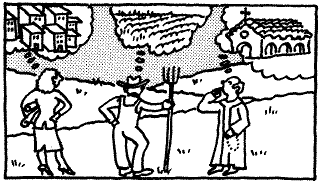
The O.S.A.E. Skills
In this document, the influence of such phenomena manifest themselves in land use and landscape modification decisions. What did the "writer-that is, the 'designer, the builder, the occupant -- have in mind when creating this landscape? Was that goal achieved? Was that goal worthy? How do these two questions bring the current observer to an evaluation of the scene?
The speculative process fits and refits elements into a more unified and productive whole. Analysis and evaluation add strong intellectual and socially useful components to the model (6).
Observation is the first step in the exploration of any primary document. For geographers, observation simply means a thorough visual analysis of the scene before them. Whether looking through a car window or a hotel window, from the rooftop observation deck of a skyscraper, or from a corner cafe, the first burden for any viewer is making order of the elements of the landscape. Begin with the obvious, then work toward a more complete picture of all that lies within the horizon being studied.
Speculation is the next logical step, although too often formal systems of education attempt to dissuade learners from "mere speculation." Speculation is the leap of logic made when some elements of a visual equation are in the mind but additional, essential components cannot be reached. In this sequence, look at the elements that compose the observation data and try to make sense of what is seen.
Analysis is the next logical step in the reading of the city landscape. Observation and speculation put together the pieces of the puzzle of the creation and utility of the city scene. There are, however, major elements such as dates, builders, exotic influences, changing occupancies and occupants. Analysis is the act of going to the library and local sources to discover the answers to the questions which arise from the speculation process.
Evaluation is the final step in this quartet. When the geographers or historians have attempted to observe and understand a city scene through the first three steps, the socially responsible observers then give some thought to the question: "How well does this scene work in this setting?" All landscape analysis questions ultimately come to questions of evaluation: Does this modification work.? For whom? How could this landscape be used more productively, or more equitably?
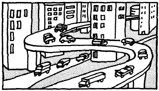
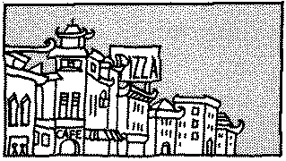
Think about these somewhat abstract terms in the context of a scene. Consider yourself on a bluff in the late afternoon overlooking the vision of a substantial city in the distance. Ask yourself, "0, SAE, Can you see?" In your observation, you can see the whole horizon centered on the city. In the middle of your vision you see the tallest buildings rising up from a low stratum of two- and three-story buildings. You observe a classic peak with almost parallel drop-offs to all sides. You can also see the bands of roadway filled with cars making their way out of the city, where lanes going into the center are much less congested. A careful observer can peel away layers of transportation, physical landscape, adjacent economic land uses that predate the city, and other developments time has allowed.
Imagine yourself making your observation at a much closer scale, and stand at a corner right in the middle of the city. You see the downward flow of people from the towers, moving quickly to gain a mythical five minutes on their competition for the freeway lanes home. With a little walking in this setting you observe a much different pace just three blocks away, among the more squat buildings you saw from the bluff.
This observation leads to the speculation on how one part of the central city is upscale, crowded, high-status, high-rise and enormously expensive, while only a five minute walk away, buildings still look solid and, in fact, seem to bespeak an elegance that was probably quite remarkable some decades ago. What leads to such critical social differences on such a tight spatial scale? Bringing your forces of observation into play again, you note that the second floors -- in fact, all floors above the first floor it seems --- are vacant or have faded "For Lease" signs sitting crooked in the windows.
Speculation leads to a consideration of stories you, or the students with you, have heard about this older part of the city before the war ("What war?"' a high school student asks). All wonder if this quiet adjacent zone could ever have been the active, central zone that geographers call the "CBD -- Central Business District."
Or, take your speculation mode to another part of the downtown and try to figure out why one street has wig shops, pawn shops, a Bus Station, and adult theaters while only two blocks away, fancy hotels and expensive shop windows showing jewelry and fine watches. How can these variant land uses occur in such close proximity? Speculation leads to the guess that the rich part of the city is moving toward the rundown section. Or perhaps the opposite (5)?
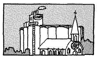
Looking carefully at the scenes before you, two large signs high on the facades of a pair of twelve story buildings can be seen. They say "The Highland Tower Shopping, Security, City Living. Now leasing ... Opening Fall 1991." Adjacent to these old buildings is a blacktop parking lot with a chain-link fence halfway around it with another sign reading "Hard Hat Area. No Visitors."'
The message in this observation and speculation is that change is abroad in the city. Old functions change and new functions, or rather new spaces for the traditional urban functions of finance, professional activity, retailing, and active interaction, are coming to this older part of the city. What are the dynamics here? What is leading to this change?
Analysis is the third step, and allows an even clearer reading of the pages of the city landscape document. Who owns the land here? What have been the patterns of ownership, tenancy, and abandonment of these areas? What transportation systems used to feed into this part of the city? Did buildings previously stand in the areas where blacktop parking lots with small kiosks now charge rates of $1.00 for twenty minutes? Who designed these middlesized buildings and when were they built? Who is behind the flashy towers that now stretch toward the gray sky?
The library is a[n] historian's source for this analysis. An interview with members of a realty office that has been based in the city for a long time might also be helpful. Checking the Sanborn maps to chronicle the change of the retail functions of this part of the city through the past five or six decades might help to answer questions and verify or modify speculations.
Analysis weds the informal reading of the city landscape document with the primary and secondary sources that await research questions and interests in the library. To cast observation and speculation toward the bibliographic task of library analysis makes the best possible use of the first three elements of the OSAE quartet of field analysis for the geographer and historian.
Evaluation is the fourth step in this process. In reading the city, any student of landscape should give time and thought to an evaluation of specific landscapes. Is this a wise use of this parcel of land? Does the landscape have environmental, social and economic merit? This step in the reading of the city is much less objective than the earlier steps (including speculation) but it does produce very stimulating discussions and landscape analysis. Just as in the reading of any primary document, the reader of the city landscape document has the burden of making inferential judgments about the context of the time and frame of mind of the author.
This paradigm for reading the city can work on any scale. It can be used productively when walking through a suburban neighborhood. It lends itself to intersections, monumental public buildings and single structures. The power of observation and speculation alone can lead to evaluation when trying to bring the process to a preliminary conclusion. The step of analysis is, of course, essential for any thorough reading of the primary source; but context provides a great deal of information allowing one level of the reading to be achieved in a day. A final field step in analysis also can be the searching out of people who have witnessed to the writing of the city landscape document. There are seniors, retailers, realtors, cops on the beat, and bankers who are sometimes interested in the process of city landscape change and analysis. If they can be captured for a few minutes, they often enjoy talking about changes they have witnessed through the years. A few phone calls can do a great deal to pave the way for such a session.
Conclusions
Like all reading, this process takes time, attention, and imagination. The first step, observation, is good education in all fields. For the geographer, it is absolutely vital. For the historian, however, it can be just as important by helping to put the pieces of the puzzle on the table. Critical thinking and real learning make use of speculation, which represents the stringing together of elements that may not initially appear to be linked.
The city is ready for evaluation right now. New shopping centers, old Central Business Districts, continuing gentrification of neighborhoods, incomplete tract developments -- all of these landscapes stand ready to be read. These primary documents are not sequestered in a rare book room, but are open to the public in a cultural landscape. Pick a city, pick a day, pick up some friends and go for a good read.
Endnotes
1. A good textbook for a broad and thorough discussion of cultural geography and the development of the cultural landscape is Terry Jordan and Lester Rowntree, The Human Mosaic (New York: Harper and Row, 1990. 5th ed.)
2. While discussions of change and the human fascination with that process are abundant, a wonderful perspective is given by a[n] historian who also had great affection for geography. See Hendrik van Loon, Man the Miracle Maker: The Story of Inventions (New York: Horace Liveright, 1928). See also Lester Rowntree et al., "Cultural Geography" in Geography in America Gary Gaile and Cort Wilmott, eds. (Columbus, Ohio: Merrill Publishing Co., 1989), 209-217.
3. Lewis Mumford is a grand chronicler of the city. In his 1968 The Urban Prospect (New York: Harcourt, Brace & World) he touches upon the theme of the city as a location accommodating a broad range of humankind. Another excellent view of this heterogeneity is Grady Clay, Right Before Your Eyes (Washington, D.C: American Planning Association, 1987).
4. There are many models for landscape analysis. Two other sources that touch on themes and approaches that are widespread are Kevin Lynch, The Image of the City (Cambridge: The Massachusetts Institute of Technology, 1960) and Christopher Salter, "Geography," in Charting a Course: Social Studies for the 21st Century (Washington, D.C.: National Commission on Social Studies in the Schools, 1989), 43-47; Joint Commission on Geographic Education, Guidelines for Geographic Education: Elementary and Secondary Schools (Washington, D.C.: Association of American Geographers, 1984).
5. An essential book when thinking about analysis of the city from the sidewalk is John Brinkerhoff Jackson, Discovering the Vernacular Landscape (New Haven, Conn.: Yale University Press, 1984).
6. The relationship of this process to geographic literacy -- an important theme to historians as well as geographers and the general -- public is illustrated in Christoper Salter, "[What is] The Essence of Geographic Literacy[?]," in Focus
, forthcoming (Summer, 1990).
Source : Magazine of History Vol. 5, No. 2 (Fall, 1990) 68-71. Drawings by Suzanne Shimek Dunaway. This article originally appeared in three columns and may do so again in the future.
Permission granted by Magazine of History, nn Mar 2001, to reprint this article.
Go to Top
Back to Greg's Home Page Back to Previous or Current Class Work Back to WebQuest Lessons
(how2read.html)gen 16 April 2001 This document first appeared on the WWW on 02 Apr 2001