Nebraska OCTA Chapter logo

Welcolme to

the Nebraska Chapter of

OREGON - CALIFORNIA TRAILS ASSOCIATION

This site was last updated 09 May 2007


What is OCTA?    Nebraska Chapter & Events    NE Trail Sites    Links to other Sites    Late Breaking Chapter News

What is the Oregon - California Trails Association?

The Oregon-California Trails Association (OCTA) is a private, not-for-profit organization dedicated to the preservation, appreciation, and enjoyment of the trans-Mississippi westward emigrant trails. OCTA works with both government agencies and private landowners to preserve and mark the trails while also helping educate the public about this fascinating period in American history. Each year, we honor those who protect the trails as well as teachers who use innovative methods to teach the history of the emigration story.

OCTA publishes a variety of materials and maintains a large bookstore of western history resources. Additionally, volunteers have been surveying emigrant documents for several years to construct a computerized database for studying the emigrant experience. The database can also help genealogists locate information about their emigrant ancestors.

Here in Nebraska you'll find outstanding trail history and sites along the routes connecting the Kansas City area with the great American West. We are proud of our history, geography and culture, and we welcome you to our beautiful state.

Go to Top

Nebraska Chapter of OCTA - Past, Present and Future Events         

Events in 2005        Events in 2006        Events in 2007

  • Please contact NE OCTA Officers to contribute ideas for other events

    Nebraska Chapter of OCTA

    Officers :

  • Event Coordinator : Loren Pospisil, Chimney Rock, Bayard NE chimrock@scottsbluff.net
  • Contact : Helen Sundell 939 S. 106th Plz, Apt 304 Omaha NE 68114-4768
  • Treasurer : Betty Scheinost - Columbus - 402 564 3401 ($10.00 annual chapter dues to her at
         2760 36th Ave. Columbus NE 68601-2342)
  • Secretary : Corrine Rickner - Columbus - 402 564 7464
  • Newsletter Editor : Carol Meyer, 1118 N. Minnesota Ave., Hastings NE 68901      cmartist-AT-inebraska.com
  • Webmeister : Greg Nelson Lincoln
  • NE - OCTA members include :

  • Oregon Trail Museum Association - P. O. Box 27, Gering NE 69341 308 436 4340
  • Nebraska State Historical Society - Lincoln
  • We encourage students and teachers to join and become involved.
  • Your name could be here ! Contact the Nebraska Chapter or OCTA today to join.

    Go to Top

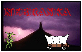
    NEBRASKA Trail Sites

    These Nebraska sites are listed by absolute geographic location, from east to west, as emigrants would have encountered them in the 19th century. If you would like to have the list appear in another format, please let us know. Obviously, not all Oregon - California sites are listed here. If you would like to contribute information or graphics for Nebraska sites, listed or not listed here, please contact the WebMeister.

    The Oregon - California Trails enter Nebraska from Kansas at Gage County, at the Oregon Trail Monument, 600 feet (183 m) east of the Jefferson - Gage County lines. From there, the Trails continue roughly east-northeasterly into the state.

  • Audubon Spring Creek Prairie (3 miles south of Denton) - The National Audubon Society purchased the 610-acre O'Brien Ranch in the summer of 1998. In November of that year, the Nebraska state office moved its operations to the ranch house. Original wagon ruts from the Nebraska City/Fort Kearny cut-off to the Oregon Trail can be seen in various locations on the property. Spring Creek features five miles of hiking trails, more than 400 acres of native tallgrass prairie, six ponds, wetlands, springs and a mature bur oak forest. A nature center is being planned on site to interpret the biological and historical significance of this and surrounding areas. Spring Creek Prairie is open to the public Monday through Friday, 9 a.m. - 5 p.m. throughout the year. Occasional weekend hours in spring and fall. Contact : Tel. (402) 797-2301 or by Email.

  • Rock Creek Station (3 miles (4.9 km) northeast of Endicott) - Mile 201.3 This is a Pony Express Station and now includes a well run State Historical Park. Setting of the historic gun fight in 1861 between David McCanles and Wild Bill Hickok.

  • Oak Grove Station - Little Blue Raid (1.7 miles (2.8 km) east of Oak) - Mile 248.9 This Pony Express station is marked by a monument commemorating an Indian massacre in 1864.

  • Simonton-Smith wagon train
  • attack site (rural Hastings ) - About 300 yards (274 m) southeast of here was the first fatal action of the Indian War of 1864. Enraged and bewildered by unprovoked attacks upon their people in Colorado Territory, the Southern Cheyenne and Arapahoe tribes determined to focus their revenge on the emmigrants. They fanned out and struck between the present day city of Hebron and the Platte River at the Adams-Kearney County line. On the hot Sunday morning of 7 August, the Indians ambushed six wagons crossing Indian Hollow. The train, owned by Thomas Simonton of Denver, was returning from St. Joseph, Missouri, under Horace G. Smith's leadership. A threshing machine, hardware, iron stoves, crockery, and foodstuffs, consigned to George Tritt, a Denver merchant, were ransacked and set ablaze. Five of the drivers were killed by arrows. The sixth, with one arrow embedded in his forehead and another in his body, crawled into hiding in a field of tall sunflowers at the bottom of the hollow. The frightened horses and mules pulled the wagons out of the ravine where the Indians cut them free of their harnesses. On the morning of 8 August, George Comstock and Overland Stage Line employees from Thirty-Two Mile Station arrived on the scene. They found the wounded teamster, who related a few details of the attack before he died. The six men were buried on the ridge beside the trail, about 140 yards (128 m) south of this point. They were the first victims of the great raids of 7 August 1864, which took at least forty-eight lives in Nebraska Territory. The monumentwas provided by Hastings Boy Scouts and was dedicated on Sunday, 17 May 1931.

  • Spring Ranch (5.7 miles (9.2 km) east of Pauline) - Mile 272.1 This is the site of a stagecoach stop, trading post and village.

  • Susan Hail Grave (4.0 miles (6.4 km) northwest of Kenesaw) - Mile 304.0 Susan, age 23, died 2 June 1852, probably of cholera. Many emigrants, including William Woodhams, described her grave
  • . Her grief stricken husband returned to St. Joseph for a tombstone and moved it by wheelbarrow back to this location.

  • Fort Kearny (Fort Childs)
  • (5.5 miles (8.9 km) Mile 319.4 southeast of Kearney) - This open fort, mostly mainly of sod and adobe, was located on bottom land south of the Platte River, near the upper end of Grand Island. Originally named in honor of Major Thomas Childs but later renamed to honored Colonel Stephen Watts Kearny. It was nortoriously uncomfortable and unhealthy but also busy and important as a supply point for the garrisons and detatchments guarding the esatern end of the Oregon Trail. The site was established in 1846-7 and abandoned in 1871. This is now a state park. This site includes a QuickTime VR movie. 1998 is the 150th anniversary of this site.

  • Midway Station (4 miles (6.4 km) south of Gothenburg) - Mile 383.2 This log structure originally had a dirt floor and earth roof. The western two thirds was probably built in 1855 and may have served as a trading post before being used as an Overland stage station and Pony Express station. In 1860 Sir Richard Burton attempted to persuade the landlady to give supper to his party but she refused. It later became part of the Lower 96 Ranch. Mark Twain made a reference to this site in Roughing It (1872), as did Charles Dawson and Mattes & Henderson.

  • Cottonwood Springs (4.4 miles (7.1 km) south of Maxwell) - Mile 406.6 These fine springs were the only good water along the trails in either direction. Charles McDonald described the camp as a cedar ranch house with a corral to the north, a stage coach station and telegraph office, grocery - liquor store, and a well. Sir Ricahrd Burton described the pan cakes as consisting of grease, molasses and dirt, in pretty equal parts. Aubrey Haines described the nearby Fort McPherson marker as a tall slab of red sandstone marking the site of the first settlement in the Platte valley, January 1860.

  • Fort McPherson (4.4 miles (7.1 km) south of Maxwell) - Mile 406.7L Only Fort McPherson's Military Cemetary remains of this Fort, important during the Indian Wars. Among the dead here lies the body of Spotted Horse, Indian Chief. Gregory Franzwa describes the momument here to the 28 men of the Grattan Massacre (near Ft. Laramie), 18 August 1854.

  • O'Fallon's Bluff (2.0 miles (3.2 km) southeast of Sutherland) - Mile 444.5 Near a low, sandstone ridge along the south bank of the South Platte River, were established a stage station and military post. Merrill Mattes wrote that it was named for a man who made his fortune selling liquor to the Indians, while Meline thought it was named after a hunter killed there by the Cheyenne and Birge understood it was named after the Indian agent, Benjamine O'Fallon, of St. Louis. Haines felt it was named after Ben or his brother John, a fur trader.

  • Beauvais Trading Post (Starr Ranch) (3.3 miles (5.3 km) southwest of Brule) - Mile 484.3 This trading post was established by Geminien P. Beauvais in 1859 to accommodate the emigrant traffic to Colorado. It was abandoned six years later due to Indian harrassment. Mattes wrote that M. O. Morris and Sarah Herndon called it the Star Ranche. This was the famous pre-1859 Upper Crossing or Old California Crossing.

  • California Crossing
  • (3.8 miles (6.2 km) west of Brule) - Mile 485.0 This crossing of the South Platte consisted of a ford requiring from three quarters to one and a half miles of travel through shallow water covering a bottom of shifting sand. James A. Pritchard wrote on 26 May 1849 that a Frenchman there acted as a pilot, charging a tin of sugar and coffee per wagon, to negotiate the shifting sand bottomed river. Irene Paden wrote that the crossing was the greatest ford of the Overland trek. Its great width, yielding quicksands and lack of large timber near at hand... prevented the operation of a ferry. Haines described the crossing on 16 July 1962 as "...a very insignificant stream due to the withdrawal of irrigation water higher up. The growth of vegetation ... has altered the open aspect of pioneer days to that of a brushy jungle where the river's course is more sensed than seen."

  • Windlass Hill & Ash Hollow State Historical Park
  • (rural Big Springs - Lewellen area) - Mile 500.8 Located near the head of Ash Hollow is a steep hill by which the main emigrant route descended into Ash Hollow, about three miles (nearly five km) south of its mouth. Wagons descended a 25 degree slope for about 300 feet (91.4 m) on a vertical drop of 150 feet (45.7 m). Erosion of the track by rear locking the wheels has left visible evidence. According to Haines, there is no evidence that a windlass was ever used at Windlass Hill. Franzwa writes in 1972 that "There is a faint set of ruts on the left [as looking from the bottom of the hill], leading down from a stone munument atop the hill which is barely visible. To the right is an angry wash, coursing down this steep grade. This is the Oregon Trail. Wagon wheels cut into the turf, pulverizing it, and the rains took it from there. The jagged scar is getting deeper." Haines on 11 July 1972 described a parking area under construction at the foot of Windlass Hill.

  • Rachel Pattison Grave - Ash Hollow Cemetery
  • (2.2 miles (3.5 km) southeast of Lewellen) Mile 504.9 The Annals of Wyoming, 1949, cite students of Lewellen High School providing the plaque, while W. W. Morrison of Cheyenne designed the monument and local residents provided materials and labor for its construction. Merrill Mattes wrote that Rachel Pattison, age eighteen, was a bride of three months when she and her husband arrived 18 June 1849. She died during the night of cholera.

  • John Hollman Grave (2.5 miles (4.0 km) south of Oshkosh) Mile 519.5 This late emigration grave site's stone is original. He died 5 June 1852.

  • Courthouse & Jail House Rocks (5 miles (8 km) south of Bridgeport) - Mile 561L4 Courthouse is a massive sandstone outcropping south of the Oregon Trail. A smaller feature to the east was called the jail house. Rufus B. Sage wrote in November 1841 "Upon the south bank of Gonneville's creek, ten or twelve miles from the river, is a singular natural formation, known as the Court House or McFarlan's Castle, on account of its fancied resemblance to such a structure. It rises in an abrupt quadrilangular form, to a height of three or four hundred feet [91 - 122 m], and covers an area of two hundred yards [183 m] in length by one hundred and fifty [137 m] broad. Occupying a perfectly level site in an open prairie, it stands as the proud palace of Solitude, amid here boundless domains."

  • Chimney Rock (3.5 miles (5.6 km) southwest of Bayard) - Mile 575 L1 1/2 This prominant column of clay and sandstone resembles a tall factory chimney. From the bottom of its funnell-shaped base to the tip of the column is over 300 feet (91 m) today. It is a unique and memorable landmark, mentioned by nearly all the diarists who passed along the Oregon Trail. Merrill Mattes cited 97 accounts of its mention, the most often described landmark along the Oregon Trail. More on Chimney Rock.        Making this document (v. 29 Jan 2004) @ UNL.

  • Rebecca Winter's Grave site (rural Scottsbluff) - Mile 591 R 2 1/2 Rebecca Winters, member of a Mormon handcart company, died enroute to Salt Lake City. She was buried in Scottsbluff on 15 August, 1852. Her grave is marked by a wagon wheel. Winters' grave was discovered in 1887 on the homestead of the Norman DeMott family, not far from the North Platte River. When DeMott sold the right-of-way across his land to the Burlington Railway Company, he stipulated in the sale that the lines through his property should not run over or disturb the grave. Addison T. Smith, Congressman from Idaho, continues the story in 1925. "As the Burlington Northern was building its line along the Platte, a crew of engineers stumbled upon a lonely little grave in the sagebrush and across it was a wagon tire, rusted and crusted with time, and on it rudely carved was these words: 'Rebecca Winters, age 50 years'

    'Boys, said the leader, we'll turn aside
    Here, close by the trail, her grave shall stay
    For she came first in this desert wide
    Rebecca Wright holds right of way.'

    And so the line of a great railroad was turned to the west that she might lie in peace in the little grave she had occupied these many years, for she was one who came with the Morman migration in 1847."

    However, her grave was relocated in 1996 1/4 mile (400 m) east near the state historical marker, between Highway 26 and the railroad, 3 miles (4.9 km) east of Scottsbluff.

  • Scottsbluff National Monument
  • (2.0 miles (3.2 km) northwest of Gering) - Mile 596 R3 1/2 This massive bluff stands like a bastion on the south bank of the North Platte River. Named for Hiram Scott, who was abandoned and presumably died at the base of the formation.

  • Mitchell Pass (2.5 miles (4.0 km) west of Gering) - Mile 597 R 2 1/2 This natural pass was used after 1850 to negotiate the prominent ridge which terminates against the North Platte River as Scotts Bluff. This route was popular among gold rush and Oregon Trail emigrants. Sir Richard Burton wrote in 1860 "We dashed down the drains and pitch holes with a viloence which shook the nave bands from our sturdy wheels."

  • Pierre D. Papin Grave
  • (6.0 miles (9.7 km) south of Gering) - Mile 597 L 3 Pierre was a well known trapper who died at nearby Fort John in May 1853.

  • Robidoux Trading Post
  • (recreated site, 9.0 miles (14.5 km) west of Gering) - Mile 600.9 This small log trading post was established by Joseph E. Robidoux 1.1 miles (1.7 km) southeast of Roubadeau Pass, in late 1848 or early 1849. Whiskey, supplies and blacksmithing were available there. Osborne Cross wrote on 20 June 1849 that "... there is also a spring of delightfully cold water ... " J. Goldsborough Bruff wrote on 7 July 1849 "This is a ... beautiful spot. Close by is a group of Indian lodges & tents, surrounding a log cabin, where you can buy whiskey for $5 per gallon; and look at the beautiful squaws of the traders. Flour here sells for 10 cents per lb." Angelina Farley wrote on 3 August 1850 "Our road passed over the bluffs at the first trading post between the forts [ Kearny and Laramie ] at a deep ravine where was an excellent spring. There we saw three wagons and part of another left."

    The Oregon - California Trails exit Nebraska at the village of Henry, Scottsbluff County, continuing west into Wyoming.

    Thanks to Greg Franzwa for permission to use excerpts from Aubrey Haines' Historic Sites Along THE OREGON TRAIL, published by Patrice Press (c) 1981. P.O. Box 85639, Tucson AZ 85754-5639 Tel. 800 367 9247 or FAX 520 743 7034. Subscribe to folio at this address.

    Go to Top

    Links to other sites : OCTA and its chapter sites

  • Oregon - California Trails Association NOTE : This site is graphic rich
  • Mailing address : P O Box 1019 Independence MO 64051-0519
  • Telephone : 816 252 2276 FAX : 816 836 0989

    Please contact OCTA for current officers, events of the past, present and future.

    Non - OCTA but Trails related sites :

  • The Trail Through Nevada
  • The Oregon Trail site includes OT Primer, sites, and bookstore
  • Oregon (The) Trail West site for Kansas, Genealogy, Oregon & photos
  • Oregon Trailride - Bayard, describes the trail ride & entertainment
  • Lincoln Highway Association includes features by state
  • PBS's Lewis and Clark video. Corps of Discovery history, native perspectives & lessons
  • PBS's In Search of the Oregon Trail video site includes facts, myths and Teacher's Guide
  • Rails - To - Trails Recreational Trail Development in Nebraska
  • Sidney_Deadwood Trail - W. Nebraska & SW South Dakota brief description
  • Route 66 includes maps, photos, and facts
  • Sesquicentennial Morman Trail includes trail explorers & geography of the California Trails
  • The Interactive Santa Fe Trail includes school projects and genealogy
  • Pony Express trail site includes new rides, descriptions
  • Chisholm Trail includes history, future events and reading list
  • Frontier Trails useful links include movies about trails
  • Overland Trail includes Concord Coach Gallery, Landmarks & Personalities
  • Union Pacific Historical Society site describes special train trips, store & magazine
  • Interstate 80 a modern 'trail' across Nebraska.
  • Overland Trails discussion group offers historical perspectives
  • H-Rural discussion group Rural & Agricultural History discussion group

    Other Links

  • Nebraska Game and Parks Commission has park & rec areas, wildlife, outdoor education
  • Scotts Bluff Regional Attractions in Nebraska's southern panhandle
  • Maps on the World Wide Web and other links.
  • Today's weather along America's western trails. Safe journey to you.

    Thanks for visiting NE-OCTA ! We hope you'll return here soon - and until then, we'll look for you along the great trails in Nebraska !

    eMail: gnelson AT inentebr.com Webmeister : Greg Nelson        Visit Greg's Home Page

    To ensure a prompt reply, please include 'NE - OCTA' in the Subject line.

    This site was hand crafted using an Apple //gs computer

    and is viewable using any browser

  • including Lynx and SIS

    Go to Top